GEOLOGIC HAZARDS
- The probability of occurrence, within a specific period of time in a given area, of a potentially damaging natural phenomenon;
- Events in which natural phenomena such earthquakes, river floods, mass movements, volcanic eruptions, etc. cause the loss of lives and damage to property;
- Mainly occur in areas where the natural factors (ie. climate & geology) are unfavorable and where the natural equilibrium has been disturbed by man
IMPORTANCE OF GEOHAZARD STUDIES
- Land use planning
- Urban development
- Disaster preparedness & management
- To minimize loss of life
- To minimize economic and social disruption
TYPES OF GEOLOGIC HAZARDS
- Mass movements or landslide hazards (pagtiris o pagrasay kan daga o bato)
- Flood hazards (pagbabaha)
- Earthquake hazards (linog)
- Volcanic hazards (pagtuga kan bulkan)
- Accelerated erosion (erosyon)
- Coastal hazards
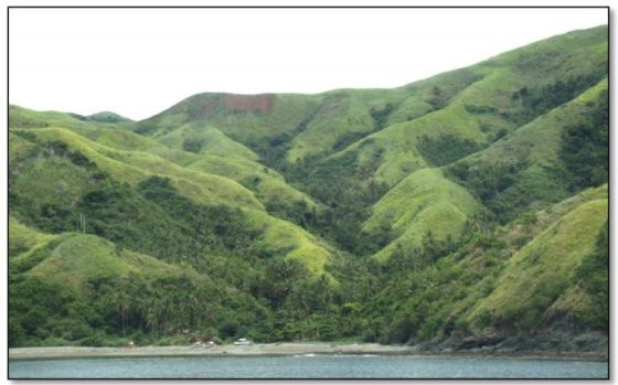
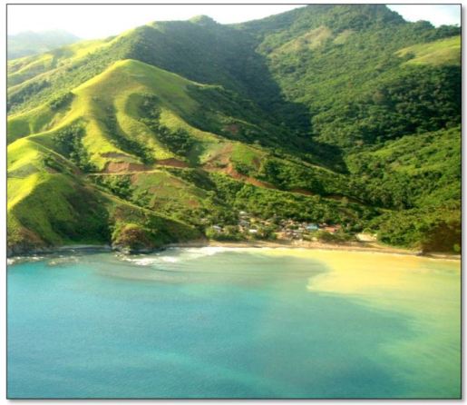
MASS MOVEMENT
Mass movement is the downslope movement of soil, debris or rock when the shear stress exceeds the shear strength of the material. It is also the denudational process where soil or rock is displaced along the slope mainly by gravitational forces.
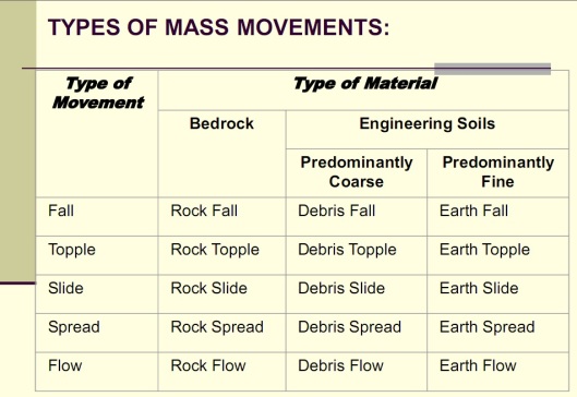
Fall consists of the detachment of soil or rock from a steep slope followed by a more or less free and extremely rapid descent of of the material. The movement is largely through the air, alternated with the bouncing or rolling on the slope.
Topple is the end-over-end motion of rock down a slope. It involves forward rotation out of the slope of a mass of soil or rock, a point below the center of gravity of displaced mass. Topple mostly occurs in combination with fall.
Slide is the moving slab of soil or bedrock that moves downslope as a a whole, remaining in contact with the underlying material. The movement is parallel to planes of weakness and occasionally parallel to slope.
Flow is the viscous to fluid-like motion of debris. It is sporadic and sudden channelized discharge of water and debris, and usually involves great internal deformation. There are three types of flow: Earth-flow, Mud-flow and Debris flow.
Creep is the slow movement of soil or bedrock down the slope. It occurs where the stresses on the slope material are too small to create a rapid failure.
MORPHOLOGICAL ASPECTS SUGGESTIVE OF LANDSLIDES:
- Steep backscarps with convex accumulation in the lower slope.
- Cracks and depressions
- Morphological steps
- Failure planes and slicken sides
- Backtilting with deranged drainage
- Irregular and hummock relief
What Causes Landslide?
Geological Causes
- Weak and sensitive material
- Weathered material
- Sheared, jointed or fissured material
- Adversely oriented fractures
- Contrast permeability
- Contrast stiffness
Morphological Causes
- Tectonic/Volcanic uplift
- Erosion of slope toe
- Vegetation removal
- Subterranean erosion (piping, solution)
- Deposition of load on slope or crest
Physical Causes
- Intense rainfall/prolonged exceptional rainfall
- Earthquake/volcanic eruption
Human Causes
- Excavation of the slope or its toe
- Deposition of load on the slope or crest
- Drawdown of reservoirs
- Deforestation
- Irrigation
- Mining
- Artificial Vibration
- Water leakage from Utilities
MITIGATION AND REMEDIAL MEASURES (STRUCTURAL)
- Rock reinforcement such as pattern of rock bolt with wire mesh and shotcrete
- Use of rock sheds
- Use of nets and rock fences to catch falling and sliding rock
- Provide adequate and appropriate slope drainage
- Flatten the slope
- Soil improvement
- Cut or fill solutions
- Rock soil anchors
- Drainage
- Geofabric
- Grouting
- Use of retaining walls
MITIGATION MEASURES (NON-STRUCTURAL)
Direct (legal) regulations
- Land use zoning
- Subdivision regulations
- Building codes
- Land registration
- Open space controls
- Public works and engineering
Financial Incentives
- Taxation (negative or positive incentives)
- Insurance and mortgage policies
Public Land Development
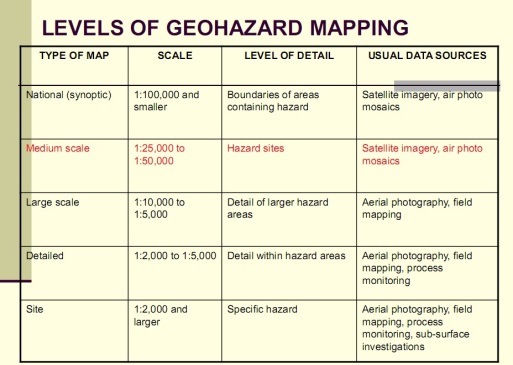
LEVELS OF GEOHAZARD MAPPING
Read More about this by Clicking Here: Landslide Hazards